Every ten years the federal government conducts a Census to see how much our population has grown. Often after a Census federal, state, and local district boundaries must change to equalize populations and reflect demographic changes.
Chatham County's population has grown by just over 11% in the past 10 years with the western part of the County seeing the largest increases.
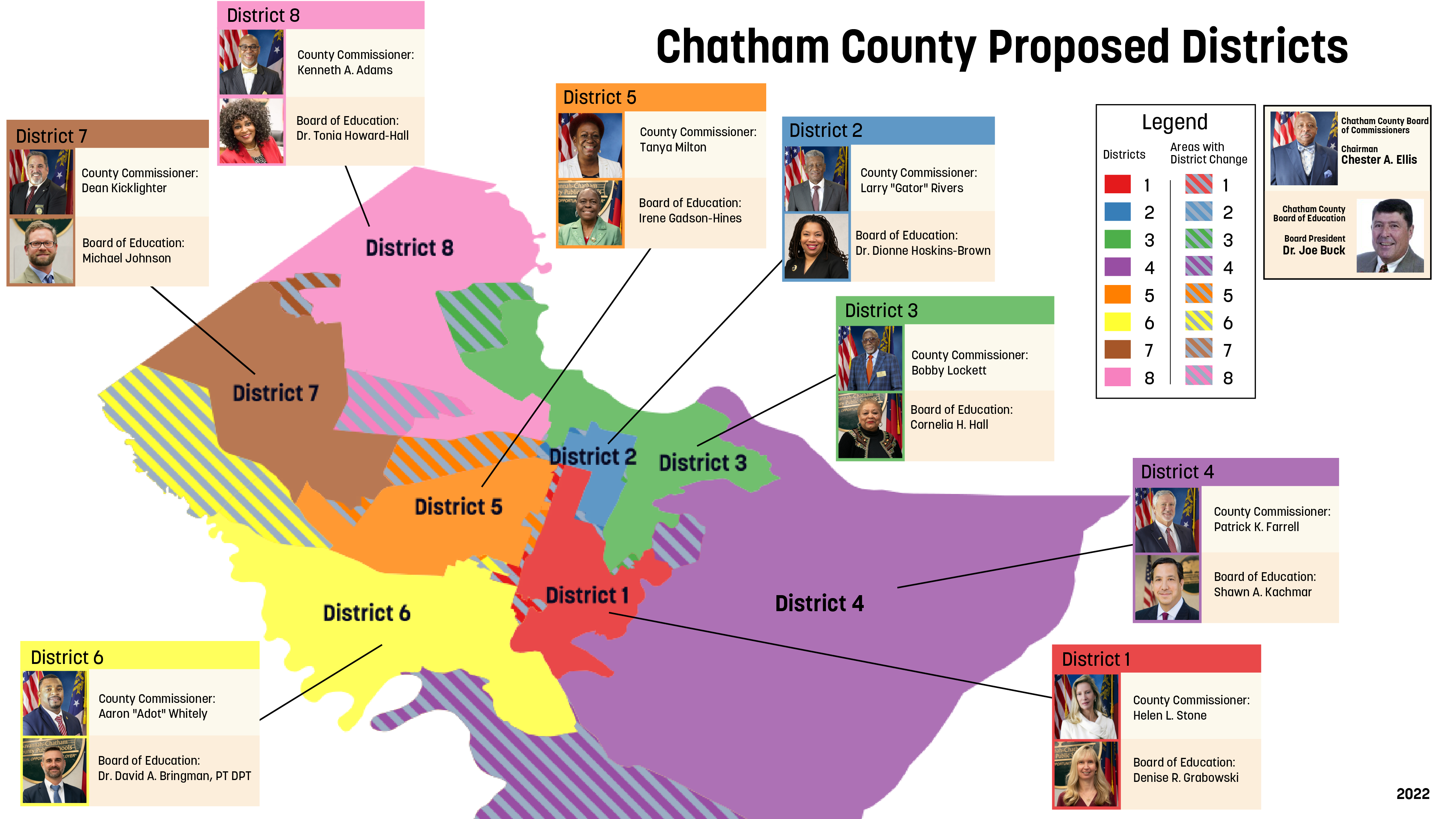
Each District should have about 36,911 residents. To accommodate population growth and people moving from one side of the County to another the District maps have been redrawn to balance the number of residents.
Below is the new proposed map (click to view larger size). Each District has been affected and if you live in any of the areas with the diagonal shaded lines you have a new County Commissioner and School Board Representative.
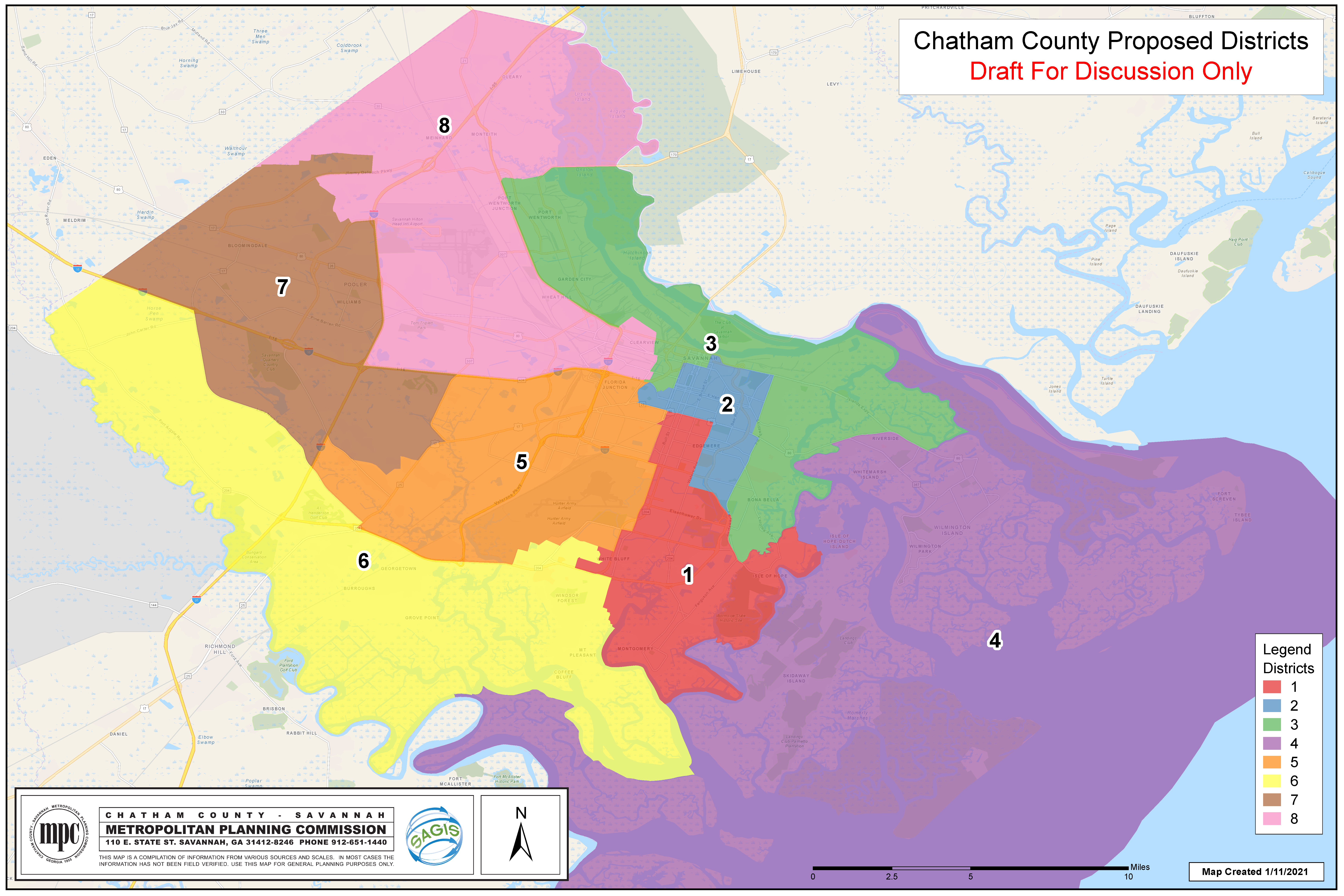
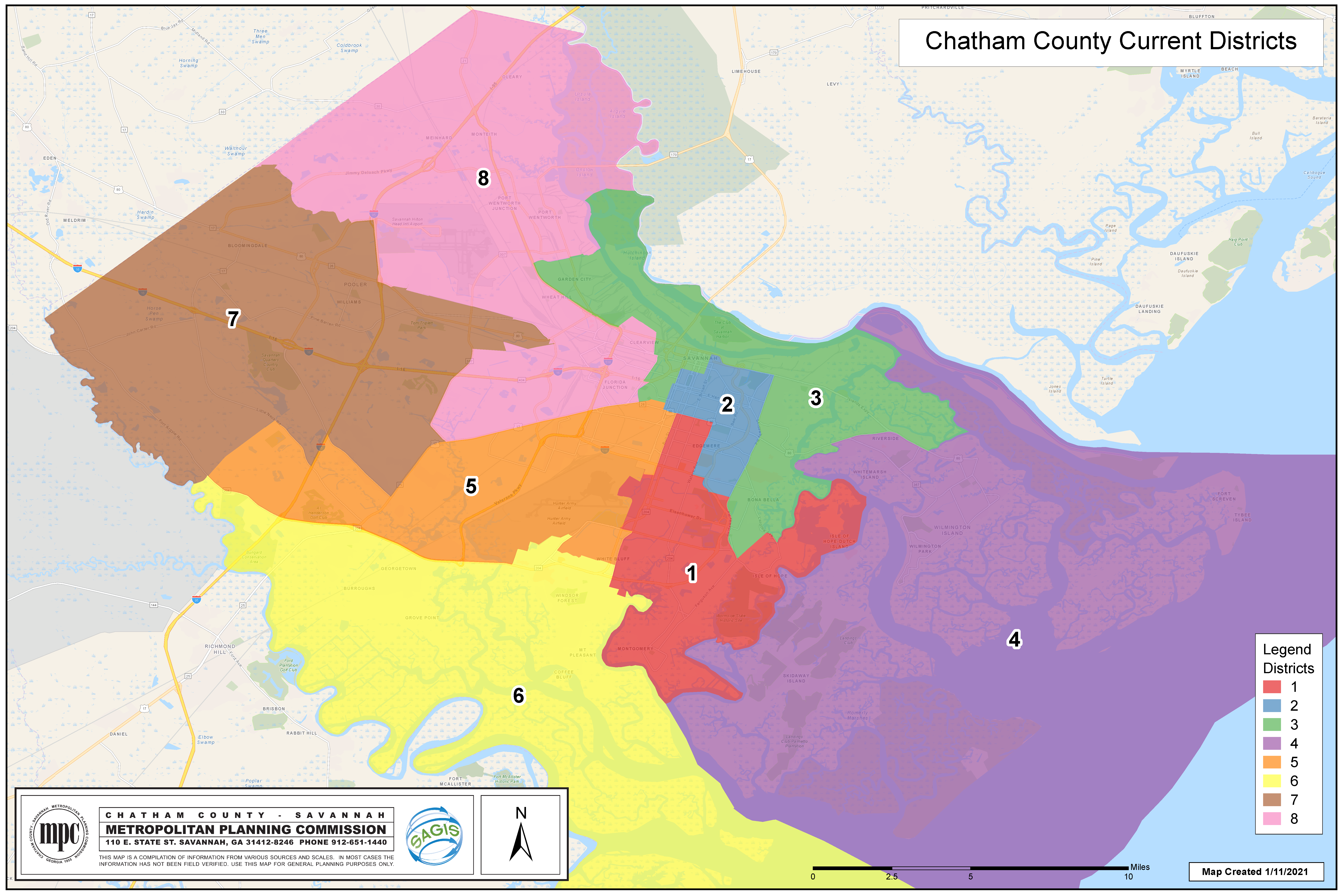
For more detailed maps of proposed and current districts with roads, please view the below maps (click to view larger size).